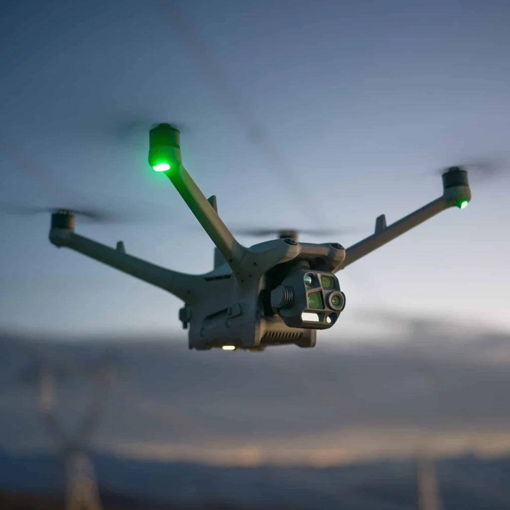
DJI Zenmuse P1

Regular price £6,100.00
Tax included Shipping calculated at checkout.

Is a professional full-frame photogrammetry camera designed for high-accuracy aerial surveying, mapping and 3D modelling.

With a 45MP full-frame sensor, interchangeable DJI DL lenses and a mechanical shutter, the P1 captures highly detailed imagery for creating accurate 2D maps, orthomosaics and 3D models.


Maintenance & Warranty

All products are covered by the applicable manufacturer's warranty, with full details provided at the time of purchase. We also offer ongoing maintenance, servicing and technical support to keep your equipment running at its best. Our team is on hand to help with repairs, firmware updates and warranty claims whenever you need us.

Need Finance Support?

Flexible finance options may be available for qualifying purchases, helping spread the cost of your investment. Our team can talk through the right payment solution for your organisation, whether you're a business, research institution or public sector body. Get in touch with our team here to find out more.

FREE Delivery

Free Delivery to UK addresses (NI £30 supplement). Most products are supplied to order, with typical UK delivery taking 4–5 weeks. Find out more here.

Subscribe to our newsletter

Sign up for exclusive offers.

High-Precision Aerial Photogrammetry

The DJI Zenmuse P1 is a professional full-frame photogrammetry camera designed for high-accuracy aerial surveying, mapping and 3D modelling.

With a 45MP full-frame sensor, interchangeable DJI DL lenses and a mechanical shutter, the P1 captures highly detailed imagery for creating accurate 2D maps, orthomosaics and 3D models.

The P1 integrates with the DJI ecosystem to provide an efficient workflow from flight planning and data capture through to processing in DJI Terra.

Smart Oblique Capture automatically collects imagery from multiple angles, helping produce detailed 3D models while reducing unnecessary images and processing requirements.

Compatible DJI Platforms

The Zenmuse P1 is compatible with:

  • DJI Matrice 400

  • DJI Matrice 350 RTK

  • DJI Matrice 300 RTK

Find The Perfect Model For Your Needs...

Compare all our top models to find the best one for you.

A table comparing the facets of 3 products
Facet
DJI Zenmuse H30
View details
DJI Zenmuse H30T
View details
DJI Zenmuse P1
View details
Price
Price
Regular price £3,880.00
Regular price £8,180.00
Regular price £6,100.00
Dimensions
Dimensions
170×145×165 mm (L×W×H)
198×166×129 mm
Weight
Weight
920±5 g
920±5 g
Approx. 800 g
Power
Power
H30: 26 W H30T: 28 W
20W
Supported Aircraft
Supported Aircraft
Matrice 400 Matrice 350 RTK Matrice 300 RTK (requires DJI RC Plus)
Matrice 300 RTK, Matrice 350 RTK, and Matrice 400
Absolute Accuracy
Absolute Accuracy
IP54
IP54
Horizontal: 3 cm, Vertical: 5 cm
-
Uncooled VOx Microbolometer
-
Ideal For
Ideal For
  • Infrastructure and asset inspection
  • Public safety and emergency response
  • Search and rescue
  • Security and situational awareness
  • Energy and utility inspection
  • Industrial inspection
  • Forestry and environmental monitoring

Infrastructure Inspection
Power lines, towers, bridges, railways and other critical infrastructure.

Energy & Utilities
Thermal inspection of electrical equipment, solar installations and industrial assets.

Public Safety & Emergency Response
Search and rescue, incident response and situational awareness.

Security & Surveillance
Long-range observation and monitoring, including low-light operations.

Industrial Inspection
Identify heat signatures, monitor equipment and inspect difficult-to-access assets.

Maritime & Offshore
Long-range visual and thermal inspection of vessels and offshore infrastructure.

DJI specifically highlights applications including asset inspection, public safety and search and rescue for the H30T.

  • Topographic surveying
  • Aerial mapping
  • Construction and infrastructure
  • Cadastral surveying
  • Digital twins and 3D modelling
  • Quarry and site mapping
  • Forestry and natural resource management
  • Heritage and conservation
  • Public safety and incident mapping

Why Buy from Axis53?

At Axis53, we supply professional UAV platforms and payloads for organisations that need more than just the hardware.

We can help you select the right DJI platform and payload for your application, with advice on configuration, deployment and ongoing technical support.

Looking to equip a DJI platform with a payload?

Contact Axis53 for pricing, availability and advice on the right configuration for your operation.